Local place names make frequent reference to the boggy/soggy nature of the Shropshire Hills - Black Hill, Black Mountain, Black Marsh, Black Rhadley, Quabbs, Rhos Fiddle, The Bog, Wild Moor, Catherton Marshes, Prolley Moor…
These boggy, soggy bits are our mires and wet flushes, often with dark, organic matter rich soils (sometimes peaty soils), hence the reference to ‘black’ in place names, referring to the dark-coloured soils. These habitats and associated features are typically found in the headwaters of river catchments, on higher ground where the source of a stream begins. Where peaty soils are present, they are to varying depths in different locations and are categorised as ‘deep peaty soils’, ‘shallow peaty soils’ and ‘soils with peaty pockets’.
More information can be found here on the locations of peaty soils across England.
Here in the Shropshire Hills, the peat map for England (held by Natural England) indicates areas where these soils are thought to be present, including:
- the largely unenclosed upland landscapes of High Open Moorland typology such as the Long Mynd and Clee Hills
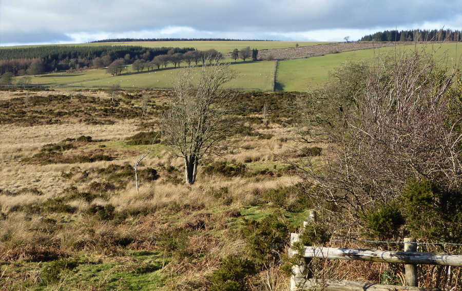
- the High Enclosed Plateau of the Clun Forest
- areas of unenclosed moorland of Upland Smallholding typology at Catherton Common
- areas of Lowland Moor at Stapeley
- on the periphery of the National Landscape there are areas of lowland deep peat amounting to c.200 hectares
Through studying OS maps and local records we have also identified 9 turbary commons (where peat would have been cut historically for fuel) and over 800 marsh/mire sites.
At a national and local scale, upland habitats different pressures. Farming, alongside forestry are important industries but intensification in places has led to soils being degraded and areas drained. Some parts of these vital upland habitats have been lost or fragmented and climate change now poses a threat with more extreme climatic conditions, such as hotter summers, adding greater pressure.
There are different examples around the country of work to protect our boggy and soggy habitats, such as the Great North Bog, focusing on large-scale peatland restoration and more locally, the Marches Mosses Bog Life Project, to protect the third largest area of lowland-raised peatbog in the UK.
Well-managed peaty soils act as large carbon stores, critical for preventing and mitigating the effects of climate change. Peaty soils and associated vegetation also act like sponges, retaining water and helping to reduce the risk of flooding. These areas are also a rich habitat, supporting a wealth of unique wildlife numerous sphagnum mosses; bilberry plants and bog asphodel; birds that rely on wetter ground such as curlew and snipe; and other species like the common lizard and marsh fritillary butterfly.
Clun peatland & headwaters study
In the Shropshire Hills, we are working with partners to better understand the Clun catchment headwaters, it’s soils and the role of water in this landscape.
To enable this area to be studied, a partnership is in place between the Shropshire Hills National Landscape Partnership, Shropshire Wildlife Trust, Natural England. Collaborative work is ongoing with landowners and to gain a greater understanding of the extent and condition of peaty soils in the Clun headwaters, alongside studying the area’s hydrology. The term hydrology refers to the distribution and movement of water both on and below the Earth’s surface. Human activity also influences water availability and it's movement.
A first phase of this study was funded by the Farming in Protected Landscapes Programme. The second phase, to understand a larger area of the Clun headwaters, has been funded by Natural England.
The first phase studied the extent and condition of the peaty soils over approximately 500 hectares. This included Shropshire Wildlife Trust nature reserves (Rhos Fiddle, Mason’s Bank and Lower Shortditch turbary), land managed for forestry and upland hill pasture managed by several private landowners. The first study was completed in 2024 and results have been shared with participating landowners. The second study is due to be completed by early 2025, covering a further 400 hectares of privately owned land.
This research has been carried out by hydrologists and is providing a local in-depth understanding of soils in the upper Clun, pin-pointing the soils rich in organic matter (shallow peaty soils) and mapping how water moves through the land. The results will inform the landowners and managers on the how to maintain and protect these special soils and also restore natural hydrology in some places where possible and beneficial to their practices on the land.
For more information please contact Rachel Glover, Natural Environment Officer, email rachel.glover@shropshire.gov.uk, or telephone 01743 255231.

