Local area section extract from Shropshire Hills AONB Management Plan 2019-24
Long Mynd – Stiperstones
(including Stapeley Hill and Hope Valley)
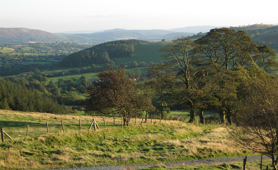
This is a ‘core’ part of the Shropshire Hills in terms of landscape, identity and biodiversity. Some of the most important large conservation sites in the region are also popular walking destinations, and lie among hill farms undergoing significant change, and sparse remote communities. Finding ways to integrate farming with conservation, and of enabling local people to benefit from sustainable patterns of use by visitors, are key to the future of the area.
The area has the biggest concentration of upland and of semi-natural habitat within the Shropshire Hills, including the largest areas of heathland. Although there is a sense of wildness, the upland commons are carefully managed and linked with the surrounding farms. The Long Mynd and Stiperstones themselves are among the most popular walking destinations in Shropshire, and the area also has a good bridleway network, is crossed by the Shropshire Way and served by the Shropshire Hills Shuttles bus service.

Much of the high ground is designated for nature conservation, and land ownership by conservation bodies (including Natural England, National Trust and Shropshire Wildlife Trust) is more extensive here than anywhere else in the National Landscape. The mosaic of habitats on farmland is also of great value, and grazing by commoners and neighbouring farmers remains important to maintaining heathlands on the hilltops. A high priority needs to be given to retaining and building the inter-relationship between conservation sites and farmed land.
The Onny Valley between the Long Mynd and Stiperstones has a strong farming character, with sparse villages, and some focal points for visitors such as Bridges and Wentnor. There is a gradual transition down the valleys from upland to more intensive lowland farms with more arable land. To the west of the Stiperstones there is more small-holding, and links become stronger across the border with Wales.
The area is important for species such as harebell and mountain pansy, small pearl-bordered fritillary and grayling butterflies, otter, dormouse, curlew, lapwing and barn owl. Small hay meadows survive, with woods on steeper slopes, and high quality rivers like the East and West Onny.

The area has an interesting geology, being crossed by the Pontesford–Linley Fault, and with minerals formerly exploited including lead and barytes. Historic features include hillforts and prehistoric settlements, classic Parliamentary enclosure field patterns on Prolley Moor and mining relics around the Stiperstones. Other significant landscape features include Mitchell’s Fold stone circle, Linley Beeches and Bromlow Callow.
Community involvement in wildlife and heritage is strong through groups such as the Upper Onny Wildlife Group and those involved with mining sites such as Snailbeach and the Bog.
The area has long views and is quiet, making it very sensitive to inappropriate development, either visually or through intrusive activities. Retaining upland farming and encouraging its activity to be in keeping with the environment is key to conserving the area’s character.
The transition of farm conservation funding to the New Environmental Land Management Scheme will be significant. Pasture-fed sheep and cattle are the main enterprises, but mixed farming can also have some environmental benefits. Many farms cross the border with Wales, thus adding an extra level of complexity for being in schemes.
Diversification is likely to continue, and the area has high potential for enterprises based on wildlife, landscape, and heritage. Increasing visitor numbers could create problems, and a sustainable, low-impact approach is necessary, minimising traffic and noise. Encouraging visitors to stay longer, experience more and spend more is preferable to simply chasing greater footfall.
Much has been achieved in this area through the Stiperstones and Corndon Hill Country Landscape Partnership Scheme which finished in 2018. While this level of activity cannot be sustained, maintaining a legacy from the scheme is important and ongoing support from organisations active in the area will help with this.
- Farm environmental schemes are vitally important as a means of delivering conservation activity on the ground, and the period of transition over the coming years is crucial. Continued active engagement with farmers and with the wider community, and advice and exchange of practical ideas have an important role to play.
- For visitors, the connection to the Shropshire Hills and links into it from the north should be developed, e.g. from Pontesbury and Minsterley. Both these settlements should benefit economically from development of more services for visitors. The profile of the area in Shrewsbury should be raised and its proximity to the Long Myns & Stiperatones is an advantage. The possibility of developing a cycle/multi-user route out of Shrewsbury in this direction would be of benefit.
- Local food activity has significant potential to act as a bridge between farming, conservation and visitors. The pubs and limited visitor facilities in the area provide an important means of developing this.


